Skip to content

Oral Presentation

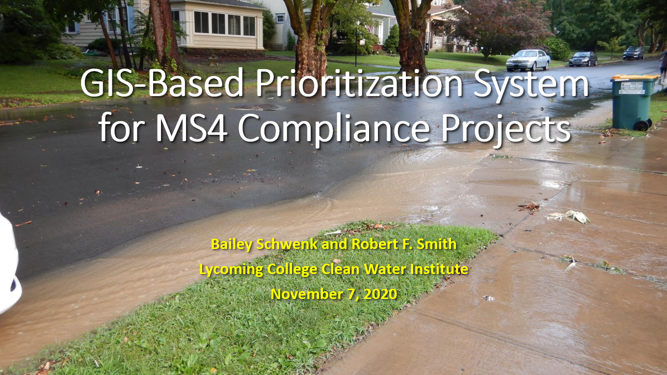
GIS-based prioritization system for MS4 compliance projects

The Clean Water Act regulates discharges of pollutants into streams and rivers, which includes point source discharges. This research aims to determine a framework for prioritizing best management practices (BMPs) and locations in urbanizing areas to fulfill the MS4 requirements. A list of criteria for BMP selection and placement was generated and GIS data consistent with the criteria were created to generate a spatial model identifying ideal BMP locations. Suitable locations for BMP’s are limited in river-towns such as Williamsport, PA. Working with local managers can improve models to help identify unintuitive locations for BMP locations, but overall prioritization systems are useful for MS4 regulated regions.

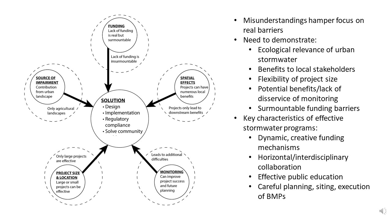
Challenges, barriers, and misunderstandings for implementing small-municipality MS4 programs

Federal regulations for municipal separate storm sewers (MS4) in the United States have been in place since 1990 as part of the Nation Pollutant Discharge Elimination System (NPDES), aiming to reduce sediment and pollutant loads originating from urban areas. However, small-municipality MS4 permittees frequently face several common challenges, barriers, and misunderstandings in their efforts to regulate stormwater. We summarize common challenges and misunderstandings concerning MS4 management and offer real-world examples of effective approaches for satisfying MS4 requirements. For example, many municipalities see no funding mechanism for implementing stormwater plans, and small municipalities are at a particular disadvantage in the absence of direct federal or state funding. Taxes are a potential mechanism yet often unpalatable to local municipalities. Grants or the creation of a stormwater utility can offset costs to local communities but also face barriers to implementation. Additionally, best management practices (BMPs) can improve stormwater quality but benefits to the local community from improved water quality are often poorly understood or mischaracterized. In spite of this, there are several MS4 management approaches that may be more approachable, including forming coalitions, forming stormwater utilities, and establishing monitoring programs. Small municipalities can benefit greatly from a realistic, facts-based clarification of MS4 policies and practices that lays out all of the options available to achieve NPDES requirements.

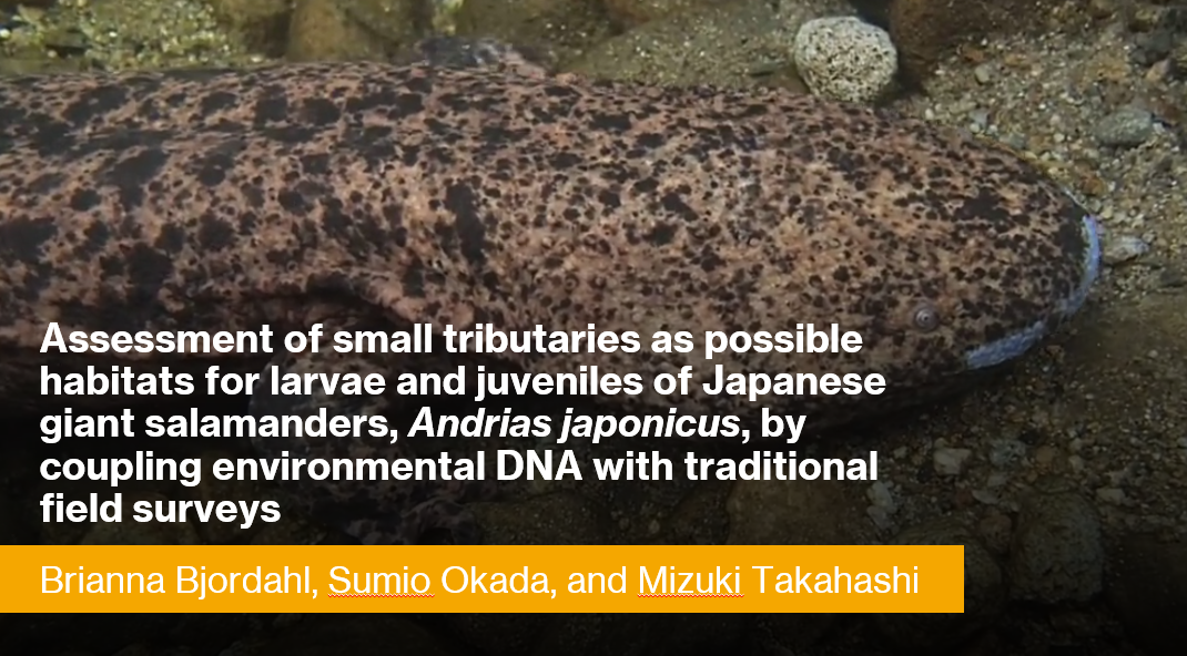
Assessment of small tributaries as possible habitats for larvae and juveniles of Japanese giant salamanders, Andrias japonicus, by coupling environmental DNA with traditional field surveys

Demographic assessments of all four cryptobranchid salamander species have continued to indicate declines over the past several decades. One of the conservation challenges facing all cryptobranchid salamanders is the paucity of information about larvae and juveniles. Larvae and juveniles have only rarely been encountered during field surveys, even in streams where adults have commonly been found. In the case of the Japanese giant salamander (Andrias japonicus), several lines of evidence imply that larval and juvenile age classes use different habitats than adults such as small tributary streams, which have been overlooked by conservation monitoring surveys in Japan. We examined small tributary streams as possible habitats for young A. japonicus by integrating eDNA analysis with traditional field surveys. During the summer of 2018, we surveyed three first-to-third order tributaries of the Ichi River in Hyogo Prefecture, Japan, and collected water samples from each stream (Stream A: 465 m stretch, N=8; Stream B: 955 m stretch, N=21; Stream C: 2,331 m stretch, N=22) for eDNA analyses. Although no A. japonicus were observed during the eDNA water sampling, we repeatedly detected A. japonicus eDNA in all streams. Given this result, we conducted field surveys in the summer and fall of 2019, consisting of a daytime survey and a nighttime survey for each of the three streams. During the daytime surveys, we found no A. japonicus in Streams A and B, whereas in Stream C we found one larva, one juvenile, and one new nest with a large adult male actively guarding, from sampling sites that showed notably higher eDNA concentrations. During the nighttime surveys, we found five adults and one juvenile from Stream A, one adult from Stream B, and 13 adults from Stream C. These results suggest the importance of small tributary streams for A. japonicus, especially for smaller breeding adults and likely for larval and juvenile development. There are numerous previously unsurveyed small tributary streams throughout the range of A. japonicus. Our results suggest that the coupling of eDNA analysis with field surveys provides an efficient monitoring tool to examine those overlooked habitats, which would further emphasize the importance of including small tributaries in the conservation management of A. japonicus and potentially the other cryptobranchid salamanders.
Carrying Capacity in Suburban Ecological Communities

Regionally in the northeastern hardwood forest ecosystems, the use of alien plants for ornamental horticulture, the escaping of those plants as invasive species, and the deliberate removal of native vegetation in the process greatly limits carrying capacity for migratory birds. Invasive plant species disrupt the natural succession of unused farmlands and open spaces. Before suburban sprawl, the spaces between cities were greater and provided a corridor between natural areas. The carrying capacity of highly developed areas can be improved by directly improving the abundance and biodiversity of native vegetation in the first trophic level. By eliminating invasive plant species, replacing alien ornamental species with native alternatives for specialist and generalist insect species, and reducing lawn area, native insect populations increase thereby improving carrying capacity and breeding success of migratory birds. This also has implications for mitigation efforts for other ecosystem processes affected by anthropogenic and environmental risks.

Stormwater Offsets: Applying Agricultural BMPs to help meet Municipal Obligations

This presentation will summarize the findings and recommendations of a USDA NRCS Conservation Innovation Grant that explored the feasibility of municipalities achieving required stormwater pollutant reductions by implementing select best management practices on agricultural lands. project team worked directly with four municipalities in Lancaster County to gauge municipal interest in these types of partnerships, identify potential projects, and develop preliminary cost comparisons between agricultural stormwater projects and urban stormwater projects. Project partners included representatives of CBF, RETTEW Associates, Red Barn Consulting, Land O Lakes, and Quantified Ventures.

Using Elevation Data to Produce an Updated Hydrography Dataset for the State of Pennsylvania

The Pennsylvania Department of Conservation and Natural Resources (DCNR) Bureau of Geological Survey (BGS) has compiled a comprehensive workflow that will be used to generate hydrography data for the new elevation-derived Pennsylvania Hydrography Dataset (PAHD). This workflow relies primarily on geomorphon classification of (QL Level 2) lidar-derived elevation data as a means of identifying potential flowpath geometries which are subsequently winnowed to remove artifacts and other irrelevant features. The geomorphon areas that remain are further processed to create a vector flowpath network. Final steps in the workflow assign attributes, some from the NHD, others by running specific tools. The end goal is a scale-equivalent and dynamic hydrography dataset for the state of Pennsylvania, created using derivatives created from quality level (QL) 2 Light Detection and Ranging (Lidar) elevation data. For the purposes of this project, “scale-equivalent” is defined as horizontal accuracy to one meter and vertical accuracy to half a meter at a 1:2,400 scale with reference to the most current elevation data. This presentation briefly examines the major components of the most current methodology for producing flowpath geometries.

How a Karst Watershed Swallowed Half of the Excess Rainfall in Its Wettest Year Ever

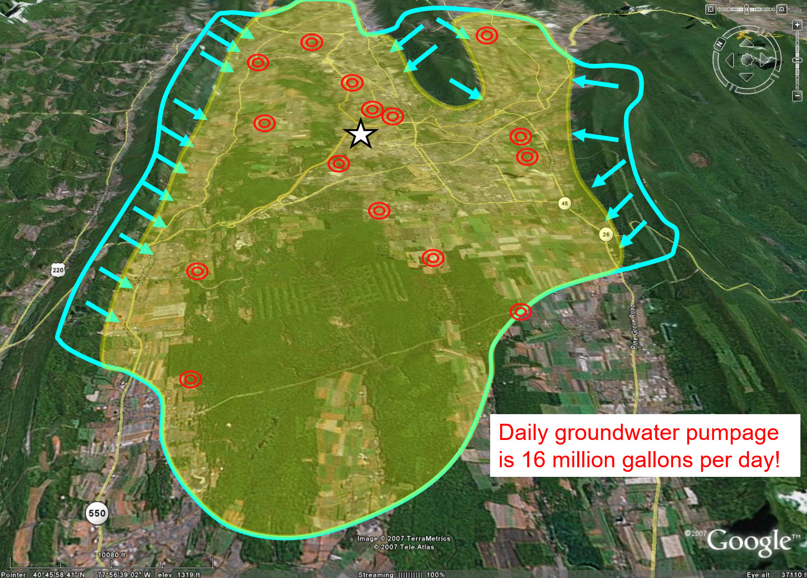
63.75 inches of rainfall and snowmelt water made 2018 the wettest year in 122 years of record for the Spring Creek Watershed in Centre County, PA. Yet it experienced very limited overbank stream flooding even though its 30-year average annual precipitation of 40.66 inches was exceeded by 57%. This presentation will explain how the unique combination of its hydrogeologic characteristics enabled this karst watershed to convert the excess rainfall into stored groundwater recharge instead of floodwater runoff. Much of the storm-water runoff from the watershed’s surrounding mountain ridges flowed into sinkholes at the base of the ridges and was directly converted into groundwater recharge, thereby mitigating storm-water flooding. You will learn the details of how this watershed’s unique carbonate flow systems took in and stored 38 billion gallons of groundwater recharge from the 70 billion gallons of above-normal precipitation for a capture ratio of 55%.

Conservation genomics of Pennsylvania-threatened Baptisia australis var. australis: an investigation in riparian gene flow

The perennial wildflower, Baptisia australis var. australis (L.) R. Br. is found along only four waterways in Pennsylvania: the Allegheny River, Youghiogheny River, Clarion River, and Red Bank Creek. Because of its limited distribution and small number of extant populations, B. australis var. australis is considered state-threatened in Pennsylvania. In addition, the riparian prairie habitat that Pennsylvania Baptisia australis var. australis is restricted to is also in decline and considered vulnerable in the state. Because of conservation concerns for Baptisia australis var. australis in Pennsylvania, gaining insights into the natural history and genetics of the taxon is useful for conservation practitioners. This project seeks to determine the genetic structure and health of known native populations and apply that information to understanding riparian gene flow, as well as establishing conservation units. Genotyping-by-sequencing (GBS) was used to collect genomic data for use in population genetics analyses. My work synthesizes these data to gain insight into the metapopulation dynamics of this riparian system and examine patterns of gene flow. We found that there are three genetic groups of Baptisia australis var. australis in Pennsylvania, with one of these showing internal genetic structure. This finding can be applied to management units for the taxon. Some Pennsylvania populations are becoming increasingly isolated as well as dwindling in population size, making now an ideal time to collect seeds and facilitate gene flow while levels of inbreeding are relatively low. My research will inform the conservation status of Baptisia australis var. australis in Pennsylvania, as well as clarify lingering uncertainties about gene flow in riparian plant populations.